| “ | The United States Government shall... Provide on a continuous, worldwide basis civil space-based positioning, navigation, and timing services free of direct user fees for civil, commercial, and scientific uses and for homeland security through the Global Positioning System and its augmentations, and provide open, free access to information necessary to develop and build equipment to use these services. | ” |
--President George W. Bush, U.S. National Space-Based Positioning, Navigation, and Timing Policy, December 2004
The Global Positioning System (GPS) is a U.S. space-based radionavigation system that provides reliable positioning, navigation, and timing services to civilian users on a continuous worldwide basis -- freely available to all. For anyone with a GPS receiver, the system will provide location and time. GPS provides accurate location and time information for an unlimited number of people in all weather, day and night, anywhere in the world.
The GPS is made up of three parts: satellites orbiting the Earth; control and monitoring stations on Earth; and the GPS receivers owned by users. GPS satellites broadcast signals from space that are picked up and identified by GPS receivers. Each GPS receiver then provides three-dimensional location (latitude, longitude, and altitude) plus the time.
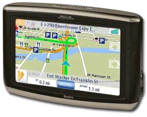
Individuals may purchase GPS handsets that are readily available through commercial retailers. Equipped with these GPS receivers, users can accurately locate where they are and easily navigate to where they want to go, whether walking, driving, flying, or boating. GPS has become a mainstay of transportation systems worldwide, providing navigation for aviation, ground, and maritime operations. Disaster relief and emergency services depend upon GPS for location and timing capabilities in their life-saving missions. Everyday activities such as banking, mobile phone operations, and even the control of power grids, are facilitated by the accurate timing provided by GPS. Farmers, surveyors, geologists and countless others perform their work more efficiently, safely, economically, and accurately using the free and open GPS signals.

What is GPS?[]
The Global Positioning System (GPS) is a U.S.-owned utility that provides users with positioning, navigation, and timing (PNT) services. This system consists of three segments: the space segment, the control segment, and the user segment. The U.S. Air Force develops, maintains, and operates the space and control segments.
- The space segment consists of a nominal constellation of 24 operating satellites that transmit one-way signals that give the current GPS satellite position and time.
- The control segment consists of worldwide monitor and control stations that maintain the satellites in their proper orbits through occasional command maneuvers, and adjust the satellite clocks. It tracks the GPS satellites, uploads updated navigational data, and maintains health and status of the satellite constellation.
- The user segment consists of the GPS receiver equipment, which receives the signals from the GPS satellites and uses the transmitted information to calculate the user’s three-dimensional position and time.
GPS Services[]
GPS satellites provide service to civilian and military users. The civilian service is freely available to all users on a continuous, worldwide basis. The military service is available to U.S. and allied armed forces as well as approved Government agencies.
A variety of GPS augmentation systems and techniques are available to enhance system performance to meet specific user requirements. These improve signal availability, accuracy, and integrity, allowing even better performance than is possible using the basic GPS civilian service.
The outstanding performance of GPS over many years has earned the confidence of millions of civil users worldwide. It has proven its dependability in the past and promises to be of benefit to users, throughout the world, far into the future.

The Future of GPS[]
Concentric circles around a woman on a cellphone indicating relative GPS accuracy of civilian service with one signal and civilian service with new signals
Stand-Alone GPS Notional Horizontal Performance with New Signals
The United States is committed to an extensive modernization program, including the implementation of a second and a third civil signal on GPS satellites. The second civil signal will improve the accuracy of the civilian service and supports some safety-of-life applications. The third signal will further enhance civilian capability and is primarily designed for safety-of-life applications, such as aviation.
The figure on the right depicts the improvement of the quality of service with the additional civilian signals. Positioning, Navigation, and Timing Policy
U.S. law and policy on GPS emphasize continuity of service, open access to civil signals, and technological leadership. In 1996, the United States issued a national policy statement on the management and use of space-based positioning, navigation and timing services, which include GPS and augmentations. It underscored the dual use (civilian-military) nature of GPS and established a joint civil-military national management structure to oversee its operation.
U.S. policy was expanded in 2004 in response to changing international conditions and the incredible growth in the types and complexities of GPS applications. This policy reaffirms the United States commitment to provide reliable civil space-based positioning, navigation, and timing services through GPS on a continuous, worldwide basis -- freely available to all. The policy also calls for improving the performance of GPS and cooperating with other nations.